


Garmin BlueChart g3 Vision Coastal Electronic Chart, VUS512L Mid-Atlantic Coverage, Auto Guidance, High-Resolution Relief Shading, Depth Range Shading, 1 ft Contours, High-Resolution Satellite Imagery, NOAA Raster Cartography


-
Perfect Fit, Guaranteed
Get the right part every time
-
Expert Support
Our in-house specialists know our products inside and out
-
Enhanced Value & Service
We go beyond the sale with professional and balanced services
-
Wordwide Delivery
Enjoy hassle-free worldwide delivery
Garmin BlueChart g3 Vision Coastal Electronic Chart, VUS512L Mid-Atlantic Coverage, Auto Guidance, High-Resolution Relief Shading, Depth Range Shading, 1 ft Contours, High-Resolution Satellite Imagery, NOAA Raster Cartography

Garmin BlueChart g3 Vision Coastal Electronic Chart, VUS512L Mid-Atlantic Coverage, Auto Guidance, High-Resolution Relief Shading, Depth Range Shading, 1 ft Contours, High-Resolution Satellite Imagery, NOAA Raster Cartography
Overview
The Garmin BlueChart g3 Vision HD VUS512L is a Mid-Atlantic electronic chart for compatible Garmin chartplotters, covering the U.S. East Coast from Barnegat Inlet, New Jersey through Jacksonville, Florida, out to Bermuda. It includes detailed areas such as the Delaware River to Trenton, the Chesapeake Bay in full, the Albemarle and Pamlico Sounds in full, and key rivers including the Savannah River and the St. Johns River.
For offshore planning, the chart set includes bathymetric coverage from Hudson Canyon to the Blake Escarpment, including major canyon areas such as Wilmington, Baltimore, and Washington Canyons. On supported displays, you can use layers like relief shading, depth range shading for up to 10 ranges, shallow water shading, and up to 1-foot contours in covered areas to get a clearer picture of bottom shape around channels, marinas, and fishing structure.
Auto Guidance route suggestions use your draft and overhead clearance settings along with chart data, and the 3D views and imagery layers help with visual reference when approaching ports and landmarks. Route guidance features are planning tools and do not replace safe navigation and a proper lookout.
Key features
- Coverage from Barnegat Inlet, NJ through Jacksonville, FL to Bermuda, including Delaware River to Trenton, full Chesapeake Bay, full Albemarle and Pamlico Sounds, Cape Fear, Savannah River to Augusta, and St. Johns River to Hastings
- Offshore bathymetric coverage from Hudson Canyon to the Blake Escarpment, including Wilmington, Baltimore, and Washington Canyons and other major offshore features
- Depth range shading for up to 10 selectable depth bands plus shallow water shading at a user-defined depth
- Up to 1-foot contours in covered areas for tighter bottom detail around structure, channels, and marinas
- High-resolution relief shading and satellite imagery overlays (where supported) for a more realistic view of surrounding features
- MarinerEye and FishEye 3D perspectives plus aerial photos in supported areas
- Auto Guidance route suggestions based on chart data and your depth and clearance settings (planning aid)
- NOAA raster chart views can be downloaded through the ActiveCaptain app on supported devices
Variants
This chart is offered in two delivery formats for the VUS512L Mid-Atlantic coverage area.
The difference between versions is how the cartography is delivered and loaded: a preprogrammed card that you insert in the chartplotter, or a download that you install to a microSD or SD card using Garmin Express.
- 010-C0741-00: Format microSD/SD. Preprogrammed media that reads directly from the card slot on compatible chartplotters, which can be convenient when swapping coverage cards between vessels or displays.
- 010-D0500-00: Format Download. Downloadable chart that installs to a microSD or SD card using Garmin Express, which suits setups where you manage charts from a computer and write them to a card when needed.
Compatibility and fit
This cartography is intended for compatible Garmin chartplotters that support BlueChart g3 Vision mapping and can read from a microSD or SD card. On a Garmin marine network, compatible chartplotters connected to the network can view the chart data using a single mapping card.
Installation and setup
For the card format, insert the chart card into the appropriate card slot on the chartplotter, power up, then select the chart in your mapping options. For the download format, Garmin Express writes the chart to a microSD or SD card, and that card is then used in the chartplotter. When installing charts with Garmin Express, one chart region is installed per microSD or SD card.
Use on board
This coverage matches boats that run the Mid-Atlantic coast, spend time in the Chesapeake and nearby sounds, or plan offshore canyon trips where detailed bottom information matters. It also fits cruisers building routes that include legs down the coast and out toward Bermuda, especially when you want depth shading and contour detail available on the plotter while underway.
We ship all in-store (FL) stock orders the same day if placed before 3 PM EST, Monday through Friday. Orders placed after this time will ship the next business day. Orders fulfilled from other warehouses or manufacturers may not ship the same day. If an item is out of stock, we will notify you promptly.
Related Products

Garmin BlueChart g3 Vision HD Coastal Electronic Chart, VUS011R Southwest Florida, Crystal River to Key Largo, Auto Guidance, High-Resolution Shaded Relief, 1 ft Contours, Up to 10 Depth Ranges, Satellite Imagery, 3D Views, NOAA Raster Charts

Garmin BlueChart g3 Vision HD VUS001R Coastal Chart, North Maine Coverage, Garmin & Navionics Data, Auto Guidance, High-Resolution Relief Shading, Satellite Imagery, NOAA Raster Cartography, 1 ft Contours
Out of stock
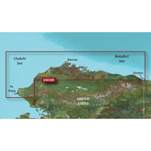
Garmin BlueChart g3 Vision HD Coastal Chart, VUS035R North Slope Alaska, Auto Guidance, High-Resolution Relief Shading, Depth Range Shading, 1 ft Contours, NOAA Raster Cartography
Out of stock
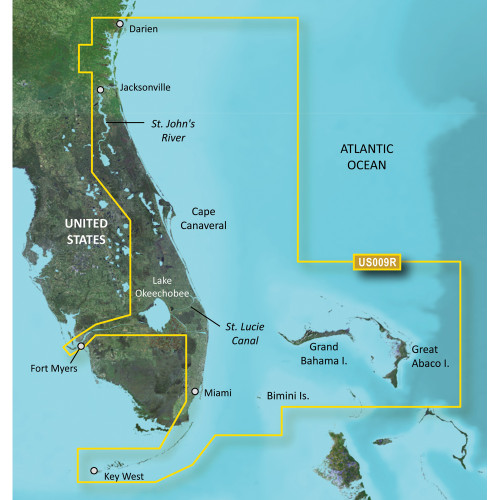
Garmin BlueChart g3 Vision HD VUS009R Coastal Chart, Jacksonville to Key West FL, Auto Guidance, High-Resolution Satellite Imagery, MarinerEye and FishEye 3D Views, NOAA Raster Cartography, Relief Shading, 1 ft Contours

Garmin BlueChart g3 Vision HD VUS511L Electronic Chart, Boston to Norfolk, Auto Guidance, 1 ft Contours, Up to 10 Depth Ranges, High-Resolution Relief Shading, NOAA Raster Cartography